The pipe, the water, and the risk to the property below
A pipe doesn't make the hill's stormwater go away. It takes the same water and gives it a more dangerous shape — concentrated, faster, and aimed at the property below. This page sets out, from physics and from the records, why a forced piped discharge raises the flood and slope-failure risk to 73 Melksham Drive — and makes one fair request: everyone who benefits should share the job of finishing it properly, or the pipe should be removed and the water left to flow naturally.
The short version. Rain and runoff from the slope and the reserve collect and run down a shared right-of-way. The council's recorded design carries that water as a broad open channel into a public sump at the bottom. At some point an uphill household laid a private pipe under the accessway to gather that flow. At first the pipe discharged onto the road; then, to get the water off the road, an uphill neighbour dug a channel — without the agreement of the two downhill owners — so the discharge now runs toward the sump beside this property. The road problem went away, and with it most of the interest in finishing the job. What's left is a half-done, concentrated discharge aimed at the lowest section, roughly 20 metres short of the sump — and one downhill owner carrying the risk while everyone who benefits has moved on.
00Why this matters
This is a downhill house at the bottom of a steep catchment. When water is mismanaged uphill, the lowest property is where it ends up — and the consequences are not abstract:
- Safety, now. In heavy rain, water gushes from the pipe and runs uncontrolled across the shared accessway. A child of the household has slipped and fallen there more than once.
- The slope, over time. Concentrated water that lands on soil and then soaks in is exactly the combination that erodes ground and undermines slopes. The deep-rooted gorse that used to hold this hillside has been cleared; the soil's natural reinforcement is gone at the same moment the water load is being increased.
- The principle — and the fair fix. Receiving the hill's natural water is accepted. A forced, concentrated pipe discharge, left half-finished and pointed at the lowest property, is not. The fair resolution is simple: everyone who benefits shares the cost of finishing it properly — a sealed connection straight into the sump — or the pipe is removed and the water flows naturally, as it did before.
How we got here
The dispute makes more sense as a sequence of events than as a set of fixed positions:
01The site, in one picture
The lay of the land decides everything here. Ground falls from about RL 106 m at the top of the catchment to roughly RL 99.7 m at the road and sump — a steep, funnelled drop. The council's surveyed records show the drainage that was designed for it.
02Same water, a more dangerous shape
Start from something nobody can argue with: water is conserved. A pipe is not a drain in the sense of "making water disappear" — it is a router. Whatever rain lands on the catchment has to go somewhere whether the pipe exists or not. So the pipe cannot reduce the amount of water arriving at the bottom. What it changes is the three things that decide whether water is harmless or harmful: how concentrated it is, how fast it moves, and where it is aimed.
This is why the engineering instinct in stormwater is almost always to spread water out and slow it down, never to gather it into a single hard point unless that point is a properly built, energy-dissipating structure that connects straight into the network. A pipe mouth firing onto bare soil is the opposite of that.
03Concentrated flow cuts and scours
Give a fast, concentrated flow somewhere soft to land and it does what fast water always does: it picks up soil and carries it away. The pipe here discharges short of the sump onto open ground, so the jet lands on soil, not into a chamber. The result is already visible — a scour channel cutting along the verge, bare eroded ground, and the tell-tale moss and permanent wet of a surface that never dries out.
04Water that sits: how soil quietly loses its strength
The most serious risk is the slowest one. Soil on a slope holds together because of friction between its grains and the "glue" of cohesion — and, where there is vegetation, the reinforcement of living roots. Water attacks all three.
When water soaks in and the ground saturates, the pressure of water in the gaps between grains (the pore pressure) rises. That pressure pushes the grains apart and carries part of the load that the grains used to carry themselves. Engineers call what's left the effective stress — and it is the effective stress, not the total weight, that gives soil its strength:
u, which lowers effective stress σ' and therefore shear strength τ. Removing deep-rooted gorse removes the root-cohesion term cᵣ. Both push the factor of safety down — at the same time.In plain terms: wet soil is weaker soil, and roots were holding this slope together. Clearing the gorse was reasonable tidying-up — but it removed a hidden reinforcement, and it is exactly the wrong moment to also start loading the ground with concentrated water. This is the mechanism behind the worry that "the soil gets weak, then it erodes, then the landscape collapses." It isn't dramatic language; it's the ordinary failure path for saturated, de-vegetated fill slopes.
05A pipe doesn't mean "less water"
The central claim from uphill is that removing the pipe would send more uncontrolled water down. Here is the careful answer: the total volume of water is set by the rain and the catchment, and is the same either way. What a pipe changes is the timing — it delivers that volume faster, so the peak flow at the bottom is higher and sharper. Higher peak, on a point discharge, is the damaging part.
✗ The claim
"The pipe is good — without it, even more water would flow onto your property."✓ The physics
The volume is fixed by rain and catchment. The pipe delivers it faster and concentrated, raising the peak and the erosive force. Spreading it back out (the open channel) lowers the peak — that's why the channel was designed that way.06What the council actually built (the lawful baseline)
This is the part the records settle cleanly. The surveyed topographical plan for this site — levels taken with a robotic total station, underground services plotted from council records — labels the council system here, in writing, as a "STORMWATER OPEN CHANNEL" feeding a "SCRUFFY DOME" (the surveyed sump), with measured levels:
| Surveyed feature | Level | What it means |
|---|---|---|
| Scruffy dome — top of concrete | RL 101.53 m | The lid level of the public stormwater inlet. |
| Scruffy dome — invert out | RL 99.68 m | Where collected water leaves into the piped network below. |
| Stormwater open channel | labelled on plan | The council's intended path: surface flow, carried broadly to the dome. |
So the consented, recorded design at this location is exactly what the physics above recommends: diffuse surface flow into a sump. It was never a single concentrated pipe discharge fired across the accessway. That distinction is the whole case.
07What the records show about the pipe
Two things here are genuinely unclear and worth settling — not assuming. First, whether the pipe was ever consented: we don't actually know, and it isn't recorded against the title. Second, a claim made from uphill that Wellington Water is the client and built the pipe. Both are easy to check, and Wellington Water's own published position is a useful starting point:
"The pipes installed to serve your property are generally private and not owned or maintained by Council or Wellington Water… When private drainage is shared by more than one property, it is the responsibility of all properties that connect to the shared or common drain to work together to maintain the pipes and resolve issues."— Wellington Water, Knowing your pipes / connecting-to-networks guidance
Under the Building Act, a new connection to a public (network utility) drainage system is specifically not exempt from building consent, and the physical connection itself must be made and inspected by Wellington Water (with notice, and the excavation left open for inspection). So if the pipe were a Wellington Water asset, or an approved connection, records would exist. Rather than argue about it, the simplest thing is to ask for them:
- [ ]A Wellington Water connection approval and inspection record for the pipe's connection to the public sump/network.
- [ ]The pipe shown as a public asset on Wellington Water's network/GIS records — not merely "private stormwater (indicative)."
- [ ]A building consent for the drainage work on the property file / LIM (required for any new connection to the public network).
- [ ]A registered drainlayer's record / producer statement for the installation.
If these records exist, they tell everyone how to finish the job correctly. If they don't, the pipe is a private, shared arrangement — which points to exactly the same fair outcome set out below. Either way, the Council and Wellington Water can confirm the status from their own records.
08The rules — and why finishing it is shared
This isn't about blame. Several independent parts of New Zealand's framework all point to the same fair outcome: the hill's water has to be managed so it doesn't damage the property below, work in a shared accessway needs everyone's agreement, and a connection to the public network has to be done properly. Read together, they make finishing the job correctly — or undoing it — a shared responsibility, not one neighbour's burden.
- Natural flow vs. concentrated discharge (common law). A lower owner must accept water that would naturally flow onto the land — that part is settled, and it is accepted here. What a lower owner is not required to absorb is water collected from a wider catchment and released in a concentrated, redirected discharge. The point of raising this isn't to threaten anyone: it's that the law has always expected concentrated water to be managed properly, which is exactly what's being asked for.
- Building Code, Clause E1 (Surface Water). Surface water "collected or concentrated by buildings or sitework" must be disposed of in a way that avoids the likelihood of damage or nuisance to other property — and "other property" expressly includes neighbouring land and the road. A pipe that concentrates flow and sheets it across the shared accessway is squarely what E1 is written to prevent. (See MBIE determination 2008/14 on surface-water runoff between adjacent properties.)
- Property Law Act 2007 — easements. A right-of-way easement is a right to cross land for access. Activities on easement land must stay within the easement's registered terms; installing a private stormwater main under a shared accessway is very unlikely to be authorised by an access easement, and would normally need the agreement of the burdened owner and the other beneficiaries.
- Water Services — connection rules. Connecting private pipework into the public network is not a private free-for-all: the connection must be applied for and made/inspected by Wellington Water, and unauthorised connections are not permitted.
- RMA / regional plan. Diverting and discharging stormwater can engage Greater Wellington's Natural Resources Plan and ss 14–15 of the Resource Management Act. Whether a consent was required here is for the regional council to assess — it is flagged, not asserted.
09"Going in circles": the claims, answered
The neighbour conversation keeps returning to the same few points. Set side by side with the physics and the records, each has a clear answer. (Quotes are paraphrased and de-identified.)
✗ Claim
"Removing the pipe would cause more uncontrolled rainwater to flow into that area."✓ Answer
Same catchment, same volume. The open channel was designed to carry it broadly to the sump at a low peak. The pipe raises the peak and concentrates the force — see Figs. 2 and 5.✗ Claim
"This system was designed by Wellington Water for this purpose."✓ Answer
What Wellington Water's records show here is an open channel + scruffy dome (Fig. 1, §06). A private pipe added under the accessway is a different thing — and one for which no approval has been produced (§07).✗ Claim
"The real problem is debris blocking the spot / moss on the path."✓ Answer
The moss and the permanent wet are symptoms of a discharge that keeps the ground saturated. Clearing debris doesn't change a concentrated point discharge landing short of the sump.Encouragingly, there is already common ground: the uphill side has itself said that connecting the pipe properly to the sump is the real solution, and that the pipe isn't recorded in the title or with the council. That is most of the way to agreement — what's left is for everyone who benefits to act on it together.
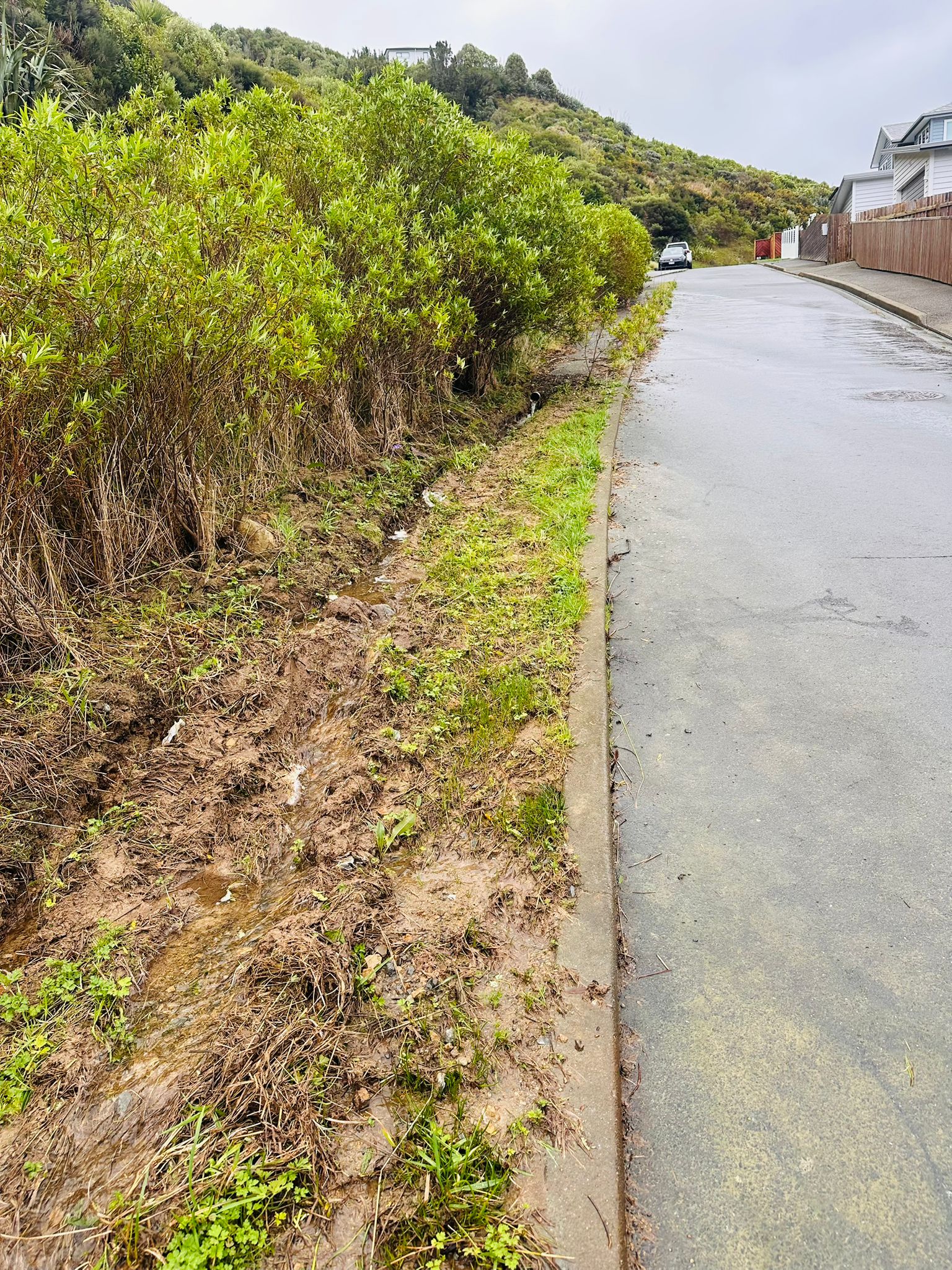
10The evidence
Photographs taken on site in wet conditions. Click any image to enlarge. House interiors and building plans are deliberately excluded; these show only the drainage, the discharge area, the scour, and the slope.
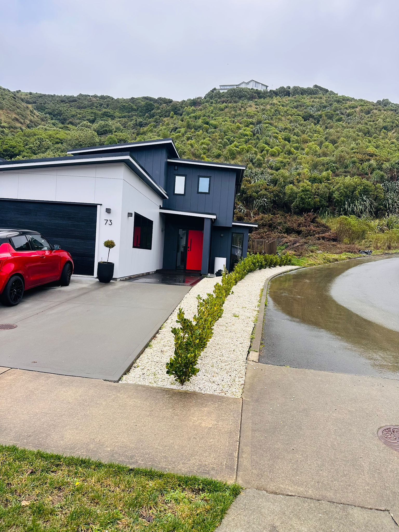
Downhill property; the shared accessway sheeting with water at the frontage.
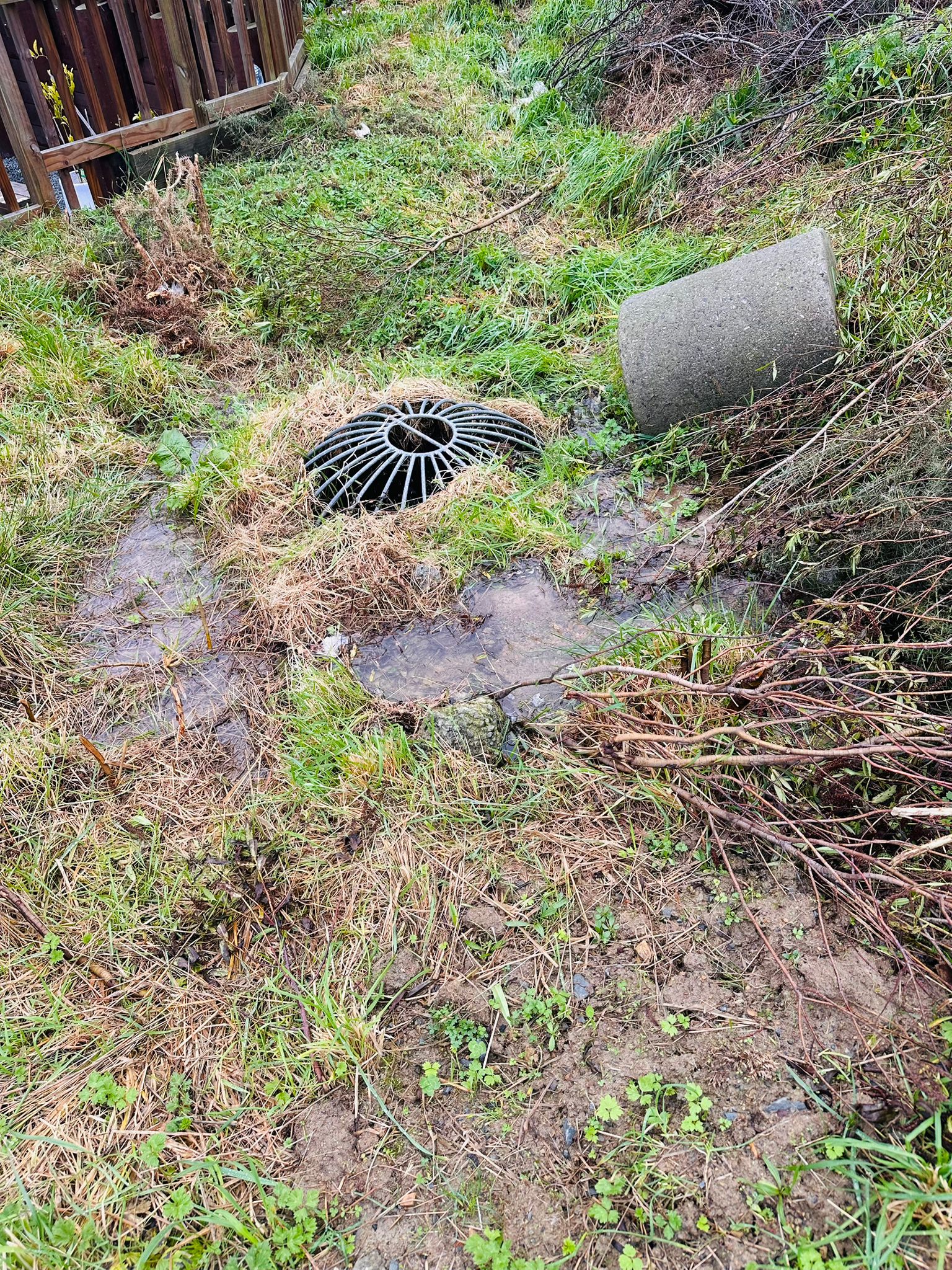
The sump (scruffy dome) with a loose pipe section beside it; water pooling on the ground, not entering the chamber.
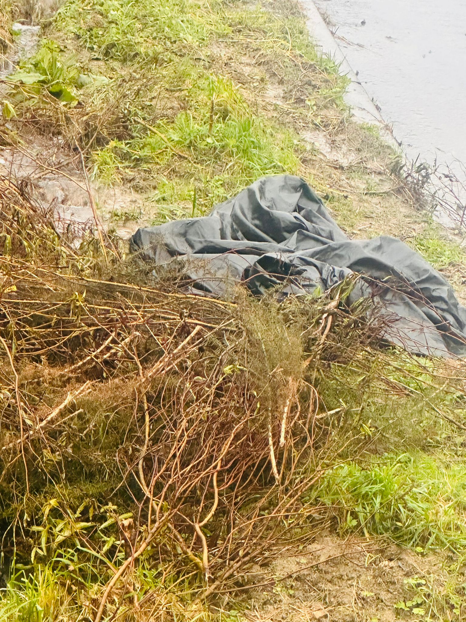
The dome, the pipe section, and the saturated, scoured verge beside the road.
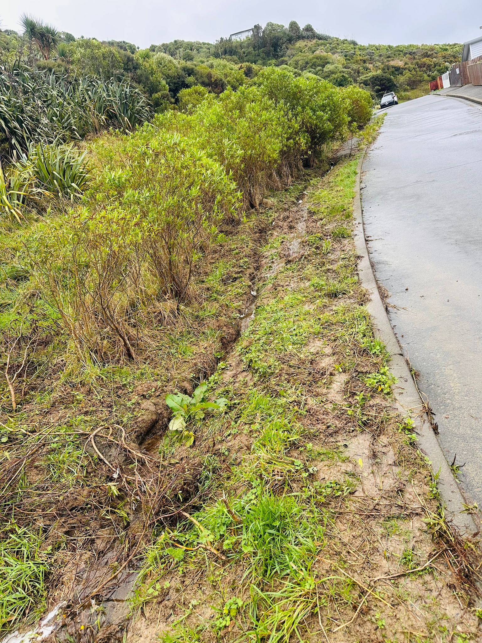
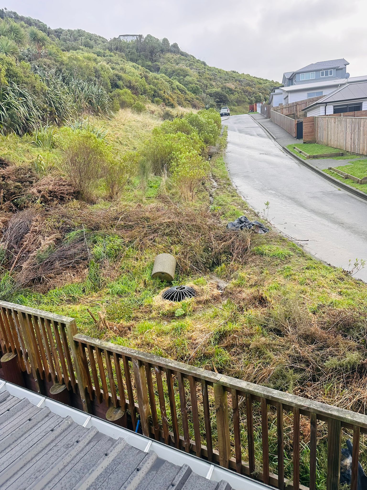
A scour channel cut by concentrated flow along the verge.
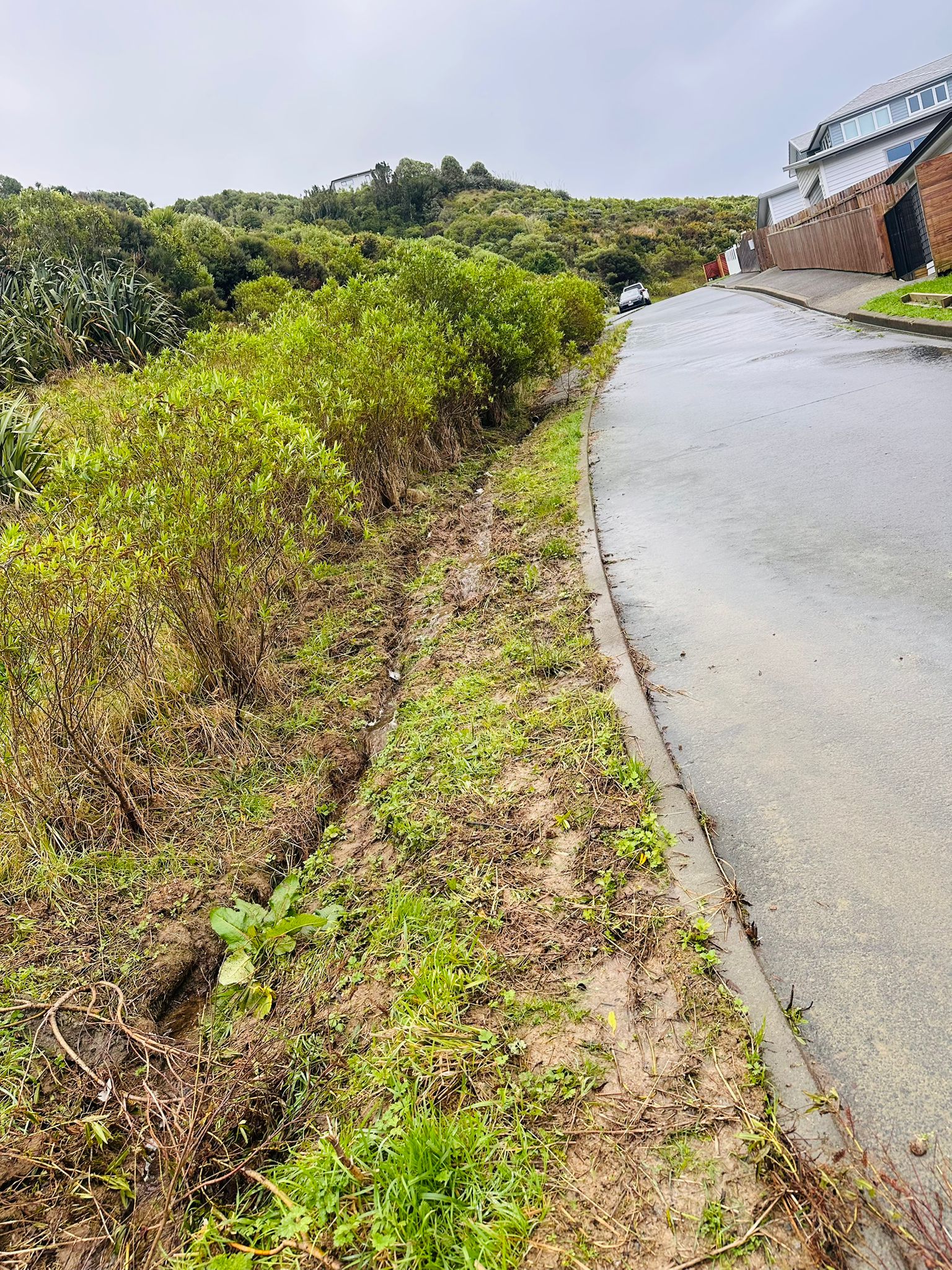
The scour line continues along the road edge; uphill properties behind.
Moss and permanent wet — a surface kept saturated by the discharge.
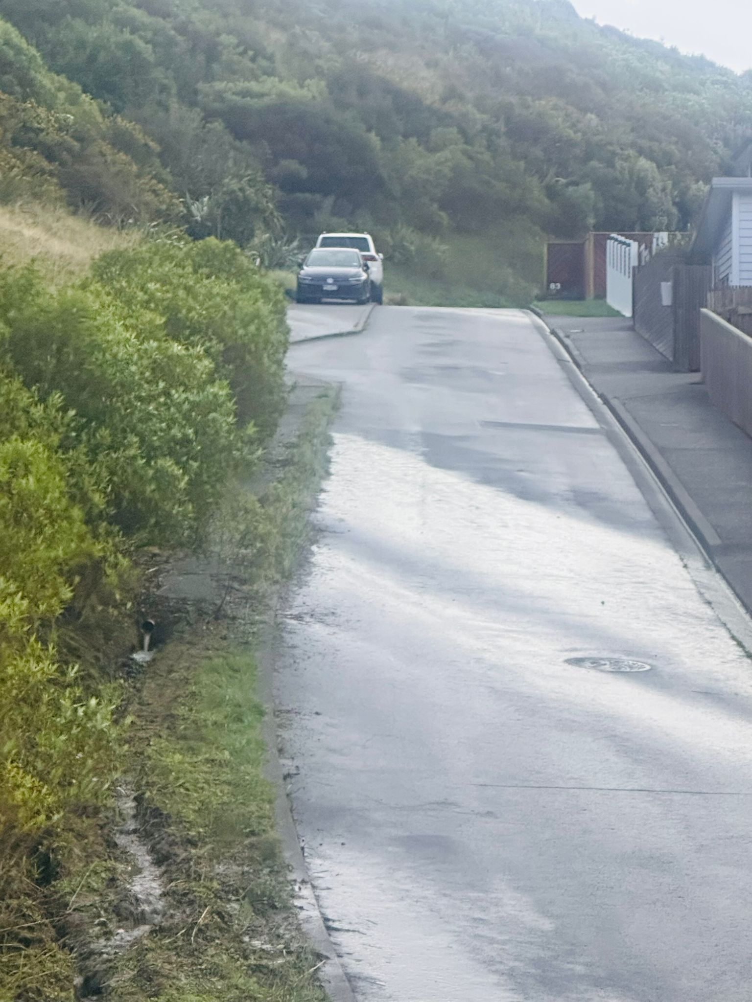
Water sheeting down the accessway from the outlet during rain.
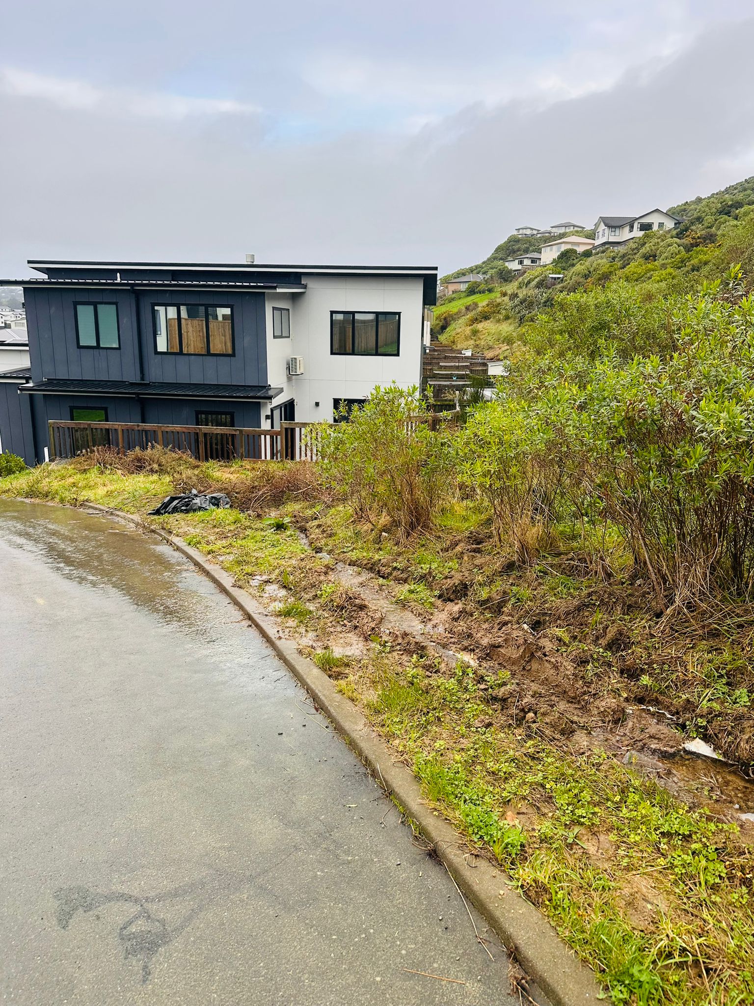
Bare, eroding embankment at the bend — surface soil being lost.
Cleared gorse and a sheet over bare soil — reinforcement removed, erosion already a concern.
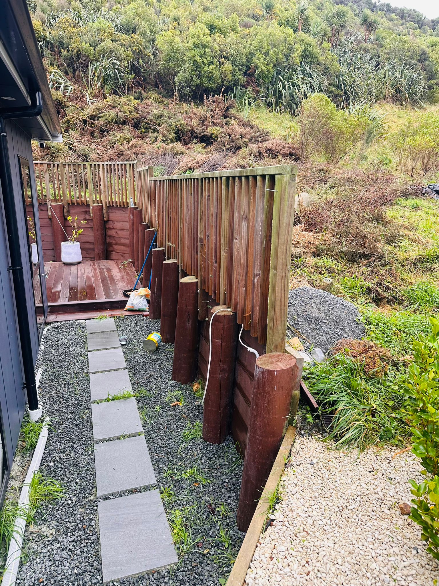
Retaining structure against the cleared slope beside the house.
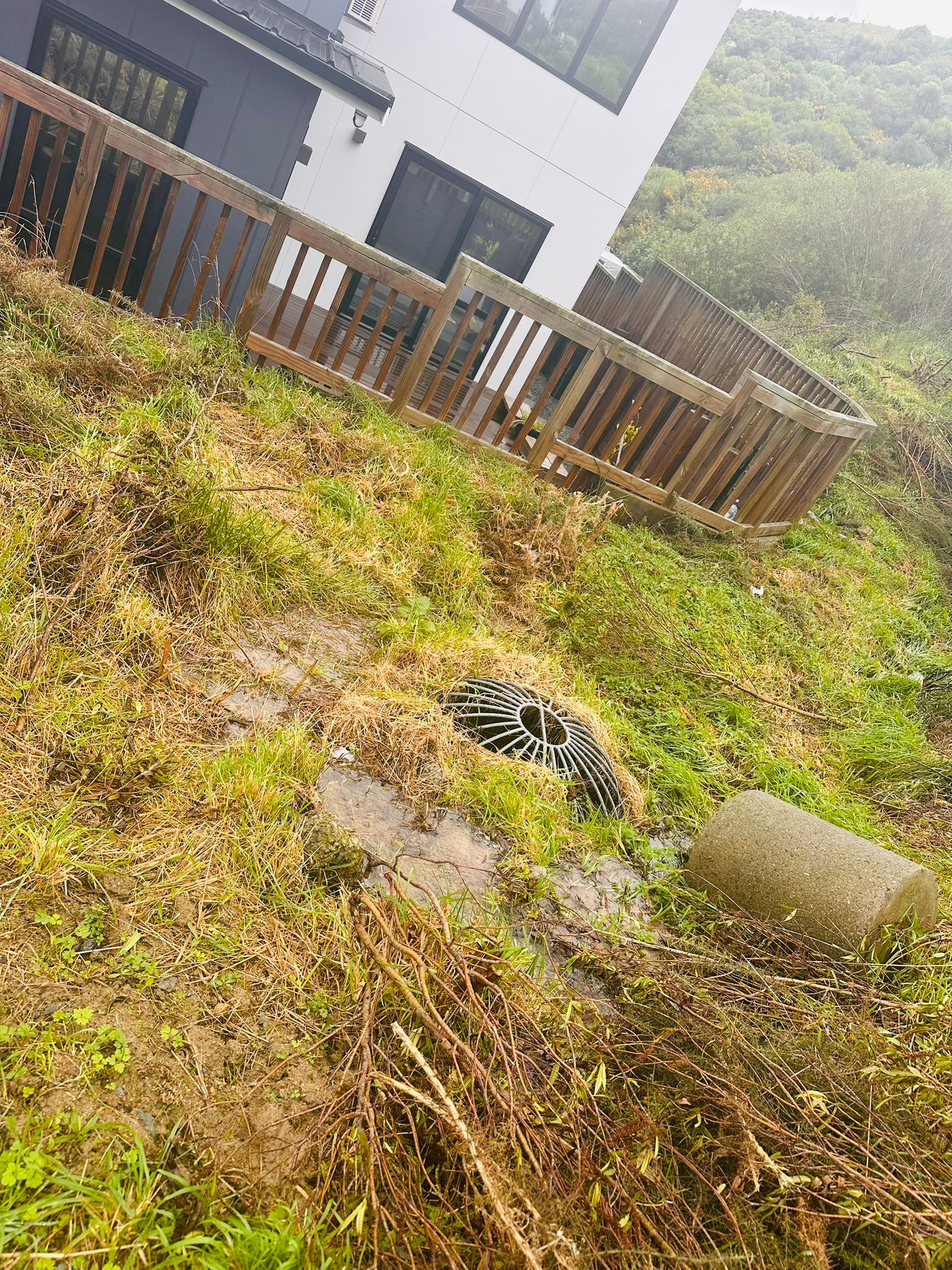
The dome in saturated ground; bare patches where flow has stripped the surface.
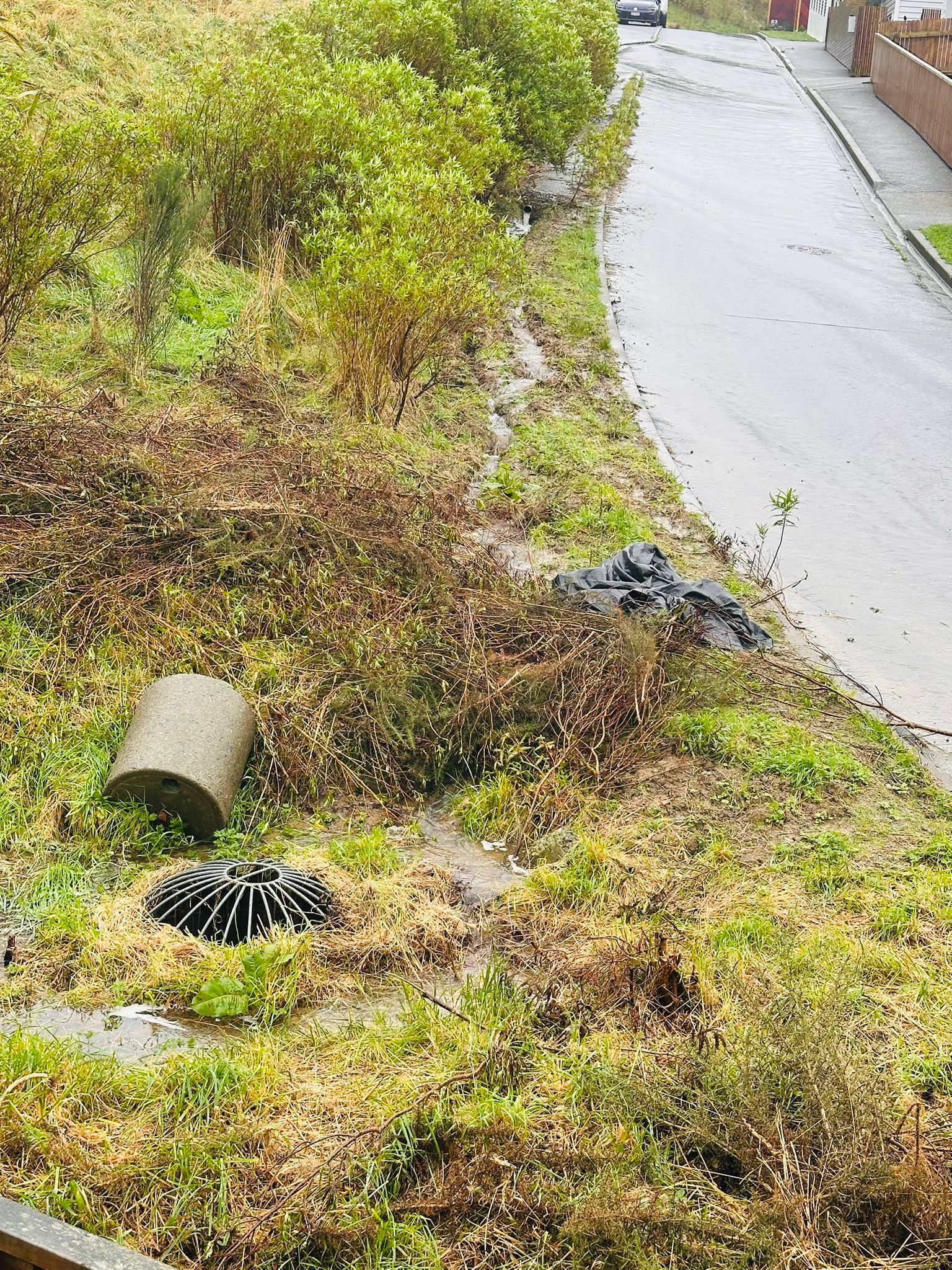
The discharge zone from above — dome, pipe section, and sheeted-over scour.
Video — flow in wet conditions
Short clips taken in the rain around the discharge point and the shared accessway. (Press play; large file sizes are kept off until you do.)
11What I'm asking — finish it properly, together, or remove it
This page isn't about blame, and it isn't a demand that any one person pay for everything. It's a request to resolve a shared problem fairly — before it becomes an expensive one.
The principle. A shared drainage arrangement is the joint responsibility of everyone who benefits from it — that is Wellington Water's own position on shared private drains, and it is simple fairness. Every household uphill that the pipe keeps dry, and the two of us below, all have a stake in it being done right.
Two outcomes I can accept:
- Finish it properly, with shared cost. A sealed underground pipe taken straight into the sump — no open trench across private land, no discharge left short — with the cost shared by everyone who benefits, including me.
- Or remove the pipe and let the water flow naturally to the open channel and sump, the way the council's design intended and the way it worked before.
What I can't accept is the present state: a concentrated discharge, half-finished, redirected toward the lowest property without the downhill owners' agreement, then left alone because it no longer troubles anyone uphill.
And I'm asking the Council and Wellington Water not to step away. This is a safety and land-stability risk to a downhill home, on a shared accessway. Confirming the pipe's status, and helping the parties reach one of the two outcomes above, is squarely within your role.
Sources & references
Authoritative, publicly available sources behind the statements above. Site-specific levels and labels are from the surveyed topographical plan held by the owner.
- Building Code Clause E1 — Surface Water — building.govt.nz/…/e1-surface-water
- MBIE Determination 2008/14 — surface water runoff between adjacent properties — building.govt.nz/…/2008-14.pdf
- Building Act 2004, Schedule 1 (building work not requiring consent — new network connections excluded) — legislation.govt.nz/…/Building Act Schedule 1
- MBIE — minor alterations to drains (exemption excludes new connection to a network utility) — building.govt.nz — minor alteration to drains
- Wellington Water — Connecting to networks — wellingtonwater.co.nz/…/connecting-to-networks
- Wellington Water — Knowing your pipes (public vs private responsibility) — wellingtonwater.co.nz/…/knowing-your-pipes
- Wellington City Council — Water Services Bylaw 2024 — wellington.govt.nz — Water Services Bylaw 2024
- Property Law Act 2007 (easements) — legislation.govt.nz — Property Law Act 2007
- Resource Management Act 1991, s14 (restrictions on taking/diverting water) — legislation.govt.nz — RMA s14
- Greater Wellington — Stormwater & resource consents — gw.govt.nz — stormwater consents
- Natural servitude — plain-English background — "Stormwater and common law's natural servitude"
- Stuart Ryan — Legal liability for water escape (NZ) — stuartryan.co.nz — water escape liability
This page is a good-faith summary prepared by the resident to explain the risk and the consent question. It is not legal advice, and statements about consent status are subject to confirmation from Council and Wellington Water records.